
Adobe PDF File eBook Ordered From This Website Will Be Delivered Within 24-48 Hours from your confirmed order as we manually process each order. Thank you for your understanding.
AVAILABLE FOR SALE


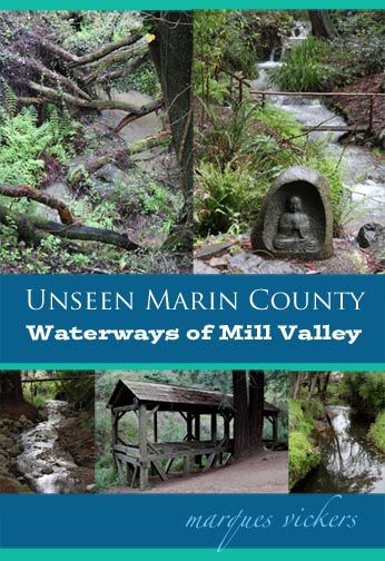
“Unseen Marin County: The Waterways of Mill Valley"
“Unseen Marin County: The Waterways of Mill Valley” is California author and photographer Marques Vickers’ visual examination of four water bodies located in the Marin County city of Mill Valley. Over 145 color images trace the routings of the Pickleweed Inlet and Mill, Corte Madera de Presidio and Coyote Creeks. The creeks that eminently flow throughout Marin County are important draining outlets originating from the elevated mountain ranges that frame the skeleton of the region. Each creek becomes an important tributary that ultimately empties into the San Francisco Bay.
The Coastal Miwok tribe inhabited the region for hundreds of years harvesting and gathering crops, hunting and fishing for salmon and steelhead trout. Their lands stretched from Marin to southern Sonoma county and Bodega Bay. European diseases with the Spanish establishment of Missions San Francisco de Asis and San Rafael decimated the native population. Following Mexican independence, the missions were closed and the lands divided into two prominent land grants. Over the subsequent two centuries, the region would evolve into upscale suburban enclaves with Mount Tamalpais looming prominently in the background.
Mill Creek
Mill Creek originates as a draining outlet on the eastern slope of Mount Tamalpais, converging with Cascade Creek at Cascade Falls. The creek flows through the downtown where an original Sawmill dating back to the 1830s remains. The creek empties into the Arroyo Corte Madera del Presidio.
Pickleweed Inlet
Pickleweed Inlet is a small bay that begins at Roque Moraes Drive and widens southward through a parkland basin area that includes Hauke and Bayfront Parks. The waters of the Corte Madera del Presidio converge from the west and Coyote Creek from the southwest before the Inlet flows into Richardson Bay. Richardson Bay ultimately merges into the San Francisco Bay.
Corte Madera del Presidio
Corte Madera del Presidio originates as a draining outlet on the eastern slope of Mount Tamalpais running southbound through the downtown. The 4.1-mile-long creek then splits and absorbs Mill Creek. The creek passes into a watershed park area before emptying into the Pickleweed Inlet.
Coyote Creek
Coyote Creek begins on Coyote Ridge at the south end of the Bothin Marsh and follows the course of Tennessee Valley Road. The creek ultimately flows into the Pickleweed Inlet.

Marquis Publishing is a publisher of paperback and electronic formatted eBooks.
MARQUIS PUBLISHING
California, USA
1 (707) 712-8062
marques@artsinamerica.com